Mobile Application · 2025
California Wildfire Tracker
A real-time mobile app aggregating critical incident data to provide a unified view of active wildfires.
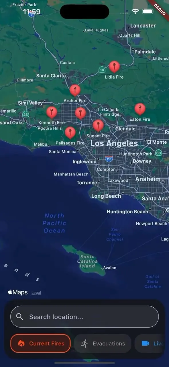
Real-time Incident Map
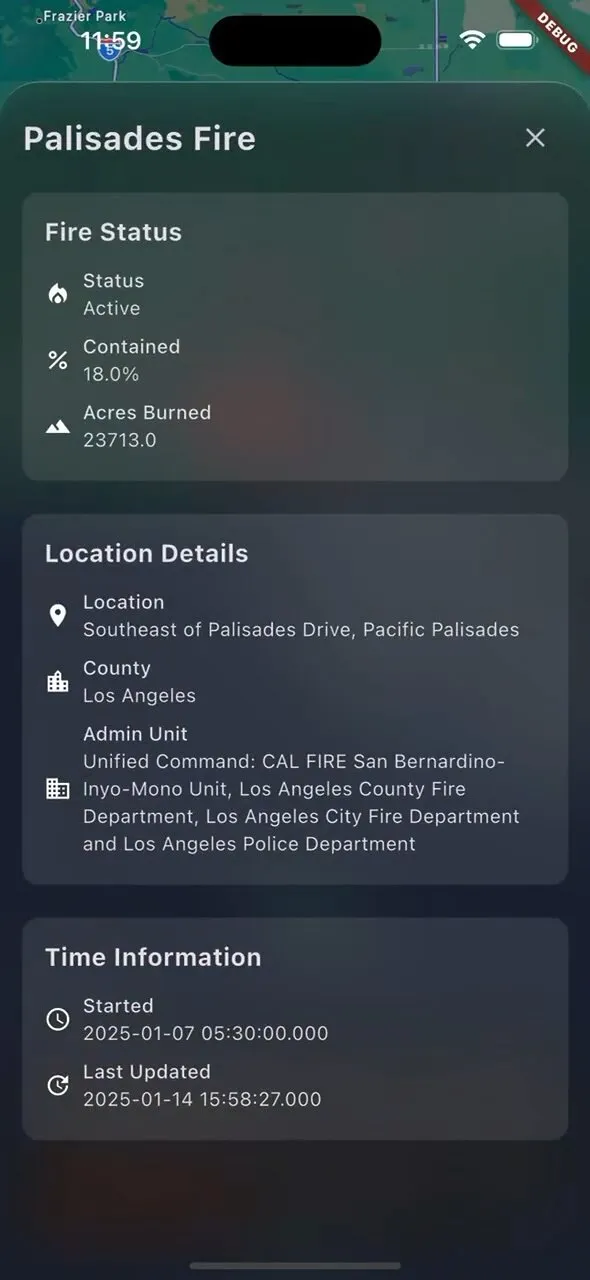
Incident Information
Project Mission
Developed during the 2025 wildfire season to address the fragmentation of public safety data. By consolidating disparate government feeds into a single fast interface, it provides immediate clarity when needed.
What it Tracks
Active Incidents
Live feed of incidents including name, location, acreage, and containment status.
Fire Perimeters
GeoJSON boundaries showing the real-time burned area footprint as map overlays.
Evacuation Zones
Precise county-level warning and order boundaries from local feeds.
Live Camera
Integration of public traffic and fire cameras for real-time visual updates.
Stack
Built with Flutter for high-performance map rendering and simple mobile responsiveness.
Data Sources
Project Status
Personal side project built as a rapid response to the 2025 wildfire season.